📋 April 2026 Update: This guide has been reviewed and updated to reflect current 2026 rules and costs.
Introduction: Yes, Japan Has Earthquakes. Here's Why People Still Buy.
Japan records more than 1,500 perceptible earthquakes per year, making it one of the most seismically active countries on Earth. Sitting at the junction of four tectonic plates — the Pacific, Philippine Sea, Eurasian, and North American — the Japanese archipelago experiences roughly 18% of the world's earthquakes of magnitude 6.0 or greater.
That sounds alarming until you consider the context: 127 million people live normal lives across these islands. Japan maintains the world's fourth-largest economy, one of the longest life expectancies on the planet, and a real estate market that attracts billions of dollars in foreign investment annually. Tokyo alone has more Michelin-starred restaurants than Paris, more Fortune 500 headquarters than any city outside China, and a residential property market valued in the hundreds of trillions of yen.
The reason people still buy — and still build — is that Japan possesses the most advanced earthquake engineering, building codes, and disaster preparedness infrastructure in the world. This is not complacency; it is the result of decades of engineering innovation driven by hard experience.
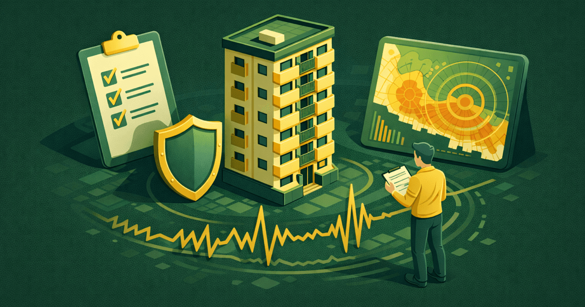
For foreign property investors, the question is not "should I avoid Japan because of earthquakes?" The question is: which risks are acceptable, and which should be avoided? This guide provides the data and framework to answer that question.
Understanding Japan's Seismic Risk
Shindo Scale vs. Magnitude
Japan uses its own seismic intensity scale called Shindo (震度), which measures how strongly shaking is felt at a specific location. This is different from the Richter magnitude, which measures energy released at the earthquake's source. The same earthquake can produce different Shindo readings at different locations depending on distance and ground conditions.
| Shindo | What You Feel | Building Impact |
|---|---|---|
| 1–2 | Slight to light shaking | No impact |
| 3–4 | Clearly felt; hanging objects swing | Items may fall from shelves |
| 5 Lower | Difficult to stand | Unsecured furniture may topple |
| 5 Upper | Cannot move without holding onto something | Walls may crack in weaker buildings |
| 6 Lower | Cannot stand | Damage to buildings with low earthquake resistance |
| 6 Upper | Can only move by crawling | Even earthquake-resistant buildings may sustain wall cracks |
| 7 | Violent shaking | Collapse risk for pre-1981 buildings |
The critical point: buildings constructed under the New Earthquake Resistance Standard (新耐震基準, enforced from June 1981) are designed to withstand Shindo 6 Upper to 7 without collapse. This is not a theoretical claim — it has been proven repeatedly in real earthquakes.
Regional Risk Overview
Not all of Japan faces the same level of seismic or tsunami risk. Geography matters enormously for investment decisions.
| Region | Earthquake Risk | Tsunami Risk | Investor Implications |
|---|---|---|---|
| Tokyo 23 Wards | Medium–High | Low (inland) | Building code compliance is critical. Liquefaction risk elevated in reclaimed land areas |
| Osaka Central | Medium | Low (inland) | Within Nankai Trough influence zone, but inland areas face minimal direct tsunami threat |
| Fukuoka | Low–Medium | Low | Relatively low seismic activity compared to Pacific coast cities |
| Okinawa | Low | Medium (coastal) | Few earthquakes, but typhoon risk is significant |
| Hokkaido (Niseko area) | Medium | Low (inland) | 2018 Hokkaido Eastern Iburi earthquake is a recent reference point |
| Pacific Coast (Chiba, Shizuoka, Kochi) | High | High | Within the Nankai Trough megaquake projection zone |
| Kyoto | Medium | Very Low | Inland location provides strong natural protection from tsunami |
The Three Things That Actually Matter for Property Investment
Every piece of earthquake-related due diligence for property investment ultimately comes down to three factors: the building's earthquake resistance standard, the location's hazard profile, and insurance coverage.
Thing 1: Building Earthquake Resistance Standard (Most Important)
The single most important factor for earthquake safety is when the building received its construction permit (建築確認, kenchiku kakunin). Japan's building codes have been strengthened multiple times, creating distinct tiers of structural safety.
| Standard | Applied From | Design Goal | Investment Assessment |
|---|---|---|---|
| Old Earthquake Standard (旧耐震) | Before June 1981 | Withstand Shindo 5 | High risk. Financing difficult. Insurance premiums elevated |
| New Earthquake Standard (新耐震) | June 1981 onward | Withstand Shindo 6 Upper to 7 without collapse | Generally safe. Check building age and maintenance |
| 2000 Standard | June 2000 onward | Enhanced wall placement balance for wooden structures | Recommended |
| Base-isolated / Damping structures | Newer buildings | Absorb or reduce seismic energy | Safest category |
The bottom line: buildings constructed after June 1981 under the New Earthquake Resistance Standard have an extremely low probability of collapse in a typical earthquake. This has been validated in every major earthquake since.
For akiya investors specifically — where the majority of inventory predates the 1981 cutoff — the structural-risk implications are explored in depth in Pre-1981 Akiya Risk 2026: Why 60%+ of Vacant Japanese Houses Fail Modern Earthquake Code.
Real-world evidence from major earthquakes:
- 2011 Great East Japan Earthquake (M9.0): Near-zero structural collapses among New Earthquake Standard buildings. The overwhelming majority of the 19,000+ deaths resulted from the subsequent tsunami, not building collapse.
- 2016 Kumamoto Earthquakes (Shindo 7, twice): New Earthquake Standard buildings sustained minor or no structural damage. Collapses were concentrated in pre-1981 structures.
- 2024 Noto Peninsula Earthquake: Same pattern — old buildings suffered disproportionate damage while newer structures held.
View building age distribution data for each area →
Thing 2: Hazard Map Verification
Japan's hazard maps are among the most detailed and accurate in the world. Before purchasing any property, four types of hazard maps should be reviewed.
① Seismic Hazard Map (揺れやすさマップ)
Ground conditions determine how strongly an area shakes during an earthquake. Reclaimed land (埋立地), areas along rivers, and former riverbeds amplify seismic waves significantly. Two buildings in the same city can experience very different levels of shaking during the same earthquake depending on the underlying soil.
- Reference: J-SHIS Earthquake Hazard Station (available in English)
② Tsunami Hazard Map
These maps show projected inundation zones — how far inland and to what elevation tsunami water is expected to reach. Pacific coast areas require particular attention due to the Nankai Trough earthquake scenario.
- Reference: Municipal government websites or Hazard Map Portal
③ Flood Hazard Map (洪水ハザードマップ)
River flooding is unrelated to earthquakes but equally relevant to property value and safety. These maps show projected inundation areas from river overflow.
- Reference: Hazard Map Portal
④ Liquefaction Risk Map (液状化マップ)
During an earthquake, saturated sandy soil can behave like liquid, causing buildings to sink or tilt. This risk is highest in Tokyo Bay waterfront areas, Osaka Bay reclaimed land, and other filled-ground zones.
- Reference: Municipal liquefaction prediction maps (available on each city's website)
Since a 2020 legal revision, real estate agents in Japan are required by law to explain hazard map information during the important matters explanation (重要事項説明, jūyō jikō setsumei) before any property transaction. If your agent does not raise this topic, ask explicitly.
Thing 3: Insurance Coverage
Fire Insurance (火災保険) — Required foundation
Fire insurance is the baseline policy that must be in place before earthquake insurance can be purchased. Standard fire insurance does not cover earthquake-caused fire — this is a common and costly misunderstanding.
- Typical annual cost: ¥15,000–¥40,000 (varies by building type, size, and location)
Earthquake Insurance (地震保険)
Earthquake insurance in Japan is a government-backed program with standardized terms. Key characteristics:
- Coverage is capped at 30–50% of the fire insurance amount (maximum ¥50 million for buildings)
- Total loss: 100% of earthquake insurance amount
- Major partial loss: 60%
- Minor partial loss: 30%
- Partial damage: 5%
- Typical annual cost: ¥7,500–¥20,000
Important limitation: earthquake insurance will not fully replace property value. The maximum payout is 50% of the fire insurance amount. This is a structural feature of Japan's earthquake insurance system, not a policy option — it applies to all policyholders.
Cost factors that reduce premiums:
- RC (reinforced concrete) condominiums are cheaper to insure than wooden detached houses
- Newer buildings qualify for lower rates
- Base-isolated and damping structures receive additional discounts
For a detailed breakdown of insurance within overall ownership costs, see our ownership costs guide.
Tsunami Risk: The Real Concern for Coastal Properties
In terms of property investment, tsunami represents a more consequential risk than earthquake shaking itself. Modern buildings are engineered to withstand severe shaking; they are not engineered to withstand being submerged in fast-moving water.
Nankai Trough Megaquake
The Japanese government's official assessment places the probability of a major Nankai Trough earthquake at 70–80% within the next 30 years. This is the most closely watched seismic scenario in Japan.
- Projected magnitude: M8–9 class
- Projected tsunami: Up to 30+ meters on certain Pacific coast sections
- Primary impact zone: Pacific coastline from Shizuoka Prefecture to Miyazaki Prefecture
Low Tsunami Risk Areas
| Area | Tsunami Risk | Reason |
|---|---|---|
| Tokyo 23 Wards (inland) | Very Low | Tokyo Bay's narrow entrance and shallow basin geometry make large tsunami penetration unlikely |
| Osaka Central | Low | Osaka Bay faces the Seto Inland Sea, not the open Pacific |
| Fukuoka | Very Low | Japan Sea coast; virtually no historical record of major tsunami |
| Kyoto | Very Low | Inland city |
| Niseko (inland Hokkaido) | Very Low | Mountain area, far from coast |
| Okinawa (inland areas) | Low | Distant from Pacific Plate boundary |
Higher Tsunami Risk Areas
| Area | Risk Level | Projected Tsunami Height |
|---|---|---|
| Kochi Prefecture (Pacific coast) | Very High | Up to 34 meters |
| Shizuoka Prefecture (coast) | High | 10–20 meters |
| Mie Prefecture (coast) | High | 10–15 meters |
| Miyagi Prefecture (coast) | Medium–High | Confirmed by 2011 experience |
Investment takeaway: properties on the Pacific coast require mandatory tsunami hazard map review. Japan Sea coast and inland locations carry substantially lower tsunami risk.
How Natural Disaster Risk Affects Property Prices
Earthquake and tsunami risk are partially — but not fully — priced into Japanese real estate. Within the same city, observable price differentials exist between areas inside and outside hazard zones.
General patterns:
- Properties within tsunami inundation zones tend to be priced 10–30% lower than comparable inland properties in the same municipality
- Areas with known liquefaction risk (e.g., parts of Koto Ward and Edogawa Ward in Tokyo) show discounts relative to neighboring areas on stable ground
- Post-1981 buildings command clear price premiums over pre-1981 buildings, partly reflecting earthquake resistance and partly reflecting financing availability
However, risk is not always accurately priced. Some buyers underestimate hazard exposure, and some sellers fail to adjust for it. This creates both opportunities and traps.
Using MLIT actual transaction data to compare price per m² within the same district — filtering by building age, distance from coast, and ground classification — reveals these risk-based price differentials clearly.
Compare area prices with MLIT transaction data →
Practical Checklist for Earthquake and Tsunami Risk Assessment
Before purchasing any property in Japan, verify the following:
1. Was the building permit issued after June 1981? Pre-1981 (Old Earthquake Standard) buildings should generally be avoided for investment purposes. Financing is difficult, insurance premiums are higher, and resale prospects are weaker.
2. Is the property outside tsunami, flood, and landslide hazard zones? Check all three hazard map categories. A property can be safe from tsunami but located in a flood zone, or vice versa.
3. Is the ground at risk of liquefaction? Reclaimed land and former riverbeds require extra scrutiny. Municipal liquefaction prediction maps are freely available online.
4. What will earthquake insurance cost, and what does it cover? Premiums vary significantly based on building age and construction type. Obtain a quote before finalizing your purchase calculation.
5. What is the building's structural type? In descending order of earthquake resistance: RC/SRC (reinforced concrete / steel-reinforced concrete) > Steel frame > Wood frame. For investment condominiums, RC construction is standard.
6. Does the building use base-isolation or damping technology? Increasingly common in newer condominiums. These systems significantly reduce shaking within the building.
7. For high-rise buildings: what is the earthquake response protocol for elevators? Modern elevators have automatic seismic shutdown systems. In a major earthquake, elevators may be out of service for hours or days. Consider whether the unit's floor level allows practical stair access.
For a comprehensive property evaluation framework beyond earthquake risk, see our complete buying guide.
The Bottom Line: Risk Is Manageable
Japan's earthquake and tsunami risk is real, but it is quantifiable and manageable through four straightforward strategies:
- Building selection: Choose post-1981 construction, preferably post-2000. RC construction is standard for investment condominiums and offers strong earthquake performance.
- Location selection: Use hazard maps to confirm the property is not in a tsunami inundation zone, flood zone, or liquefaction-prone area.
- Insurance: Purchase earthquake insurance. It will not cover 100% of rebuilding costs, but it provides essential baseline protection.
- Diversification: Avoid concentrating all investment in a single geographic area.
Japan's RC condominiums built to the New Earthquake Resistance Standard are among the most earthquake-resistant residential structures in the world. In the 2016 Kumamoto earthquakes — where the same area experienced Shindo 7 twice within 28 hours — there were zero recorded collapses of post-1981 RC condominiums.
Make decisions based on data, not fear. MLIT transaction data, government hazard maps, and building registration records provide all the information needed to assess and manage earthquake risk for any property in Japan.
Explore location data and building age analysis →
Frequently Asked Questions
Has a modern (post-1981) condo ever collapsed in an earthquake?
In every major earthquake since 1981 — including the 2011 Great East Japan Earthquake (M9.0), the 2016 Kumamoto Earthquakes (Shindo 7 × 2), and the 2024 Noto Peninsula Earthquake — there are no recorded cases of post-1981 RC condominiums collapsing. Damage to newer buildings has been limited to non-structural elements such as cracked exterior walls, broken windows, or displaced ceiling tiles.
Should I avoid buying in Tokyo because of earthquake risk?
Tokyo faces significant seismic risk, but it also has the most advanced earthquake preparedness infrastructure in the world — from building codes to emergency water supplies to neighborhood-level disaster response organizations. The key factors are choosing a post-1981 building on stable ground (avoiding reclaimed land areas), confirming hazard map status, and maintaining earthquake insurance. Millions of people own property in Tokyo with full awareness of the seismic risk.
What about the Nankai Trough earthquake?
The Japanese government estimates a 70–80% probability of a major Nankai Trough earthquake within the next 30 years. The primary risk is tsunami along the Pacific coast from Shizuoka to Miyazaki. Inland areas and Japan Sea coast areas face substantially lower risk from this specific scenario. This is precisely why location selection using hazard maps is critical for investment decisions — the risk varies enormously depending on exactly where a property is situated.
Is earthquake insurance worth it?
Yes, particularly for foreign investors who may not be physically present in Japan after a disaster. Earthquake insurance provides funds for immediate recovery — temporary housing, emergency repairs, and partial rebuilding. However, understand its limitation: the maximum payout is 50% of the fire insurance amount. It will not fully replace property value. Despite this cap, the relatively low annual premium (¥7,500–¥20,000 for most condominiums) makes it a rational cost of ownership.
Are there areas in Japan with almost no earthquake risk?
No area in Japan is completely free of earthquake risk. However, Fukuoka, Okinawa, and parts of the San'in coast (Japan Sea side of western Honshu) have historically low seismic activity. These areas may carry other natural disaster risks — Okinawa faces significant typhoon exposure, for example. The lowest combined natural disaster risk in Japan tends to be found in inland areas of Kyushu and the western Japan Sea coast.
Does earthquake risk affect property prices?
Partially. Properties in tsunami inundation zones or on liquefiable ground tend to be priced lower than comparable properties in safer locations, but the discount does not always fully reflect the actual risk. Using MLIT transaction data to compare prices within the same municipality — filtering for building age and distance from hazard zones — can reveal risk-based price differentials that inform smarter investment decisions.
Compare area prices with MLIT data →
Related Articles
- Pre-1981 Akiya Risk 2026: Why 60%+ Fail Modern Earthquake Code → — The structural risk applied specifically to vacant Japanese houses and foreign buyers
- Akiya Renovation Costs 2026: Real Examples by Region → — Including earthquake retrofit budgets by region
- Japan's 9 Million Vacant Houses 2026: Government Data → — The pre-1981 housing stock that drives the akiya inventory
- Japan Tsunami Risk for Coastal Property Foreign Buyers 2026 → — Tsunami-specific risk for coastal investments
- Japan Property Insurance for Foreign Owners → — Earthquake and fire insurance mechanics for foreign owners
- The Complete Guide to Buying Property in Japan
- Japan Real Estate Investment Metrics Explained
- Owning Property in Japan: Monthly & Annual Costs
- New vs Used Property in Japan: Which Is Better?
This article is for informational purposes only. Earthquake and tsunami risk assessments should be verified using official government hazard maps and professional geological surveys. Insurance coverage details should be confirmed with licensed insurance providers. Natural disaster risk can never be eliminated entirely.